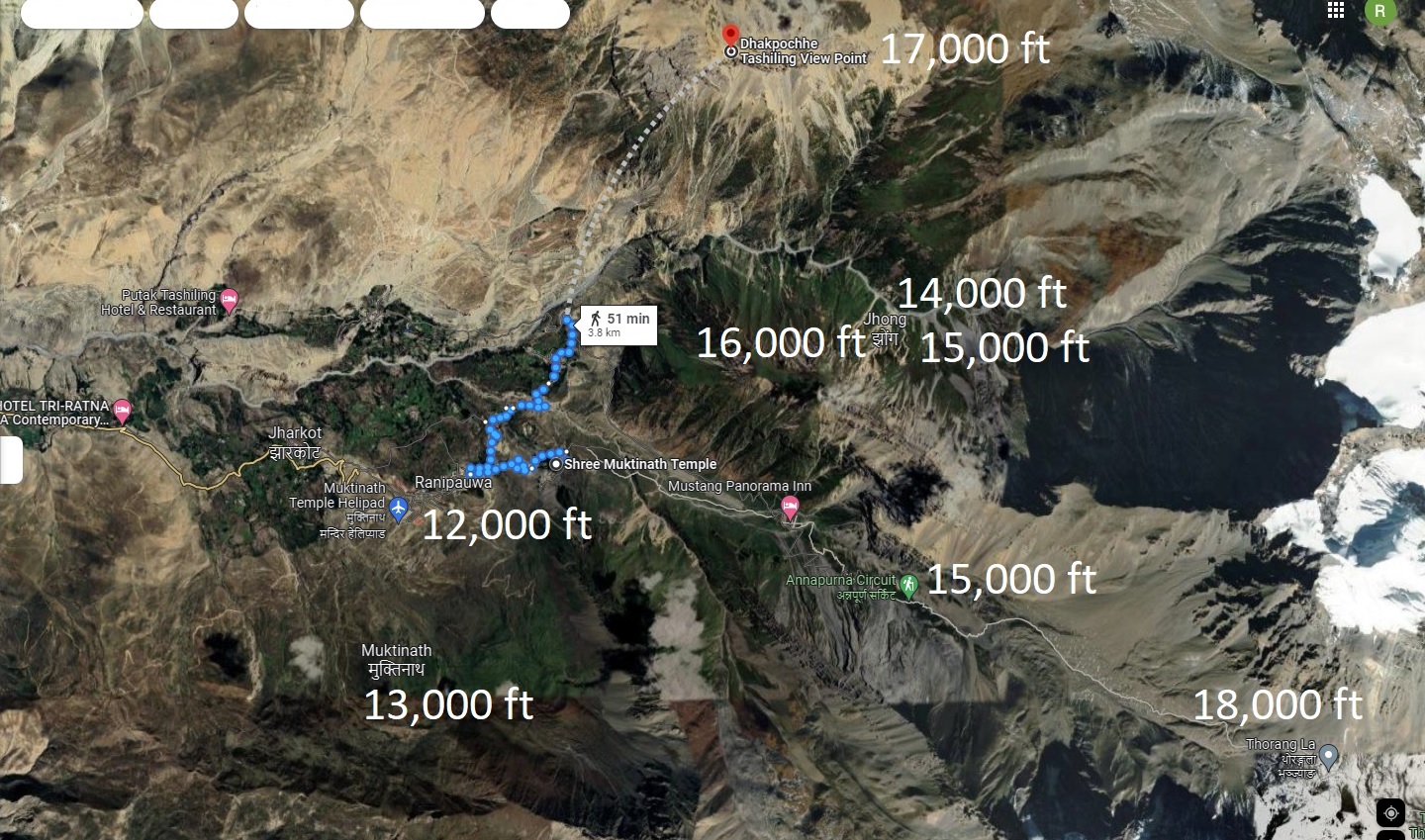
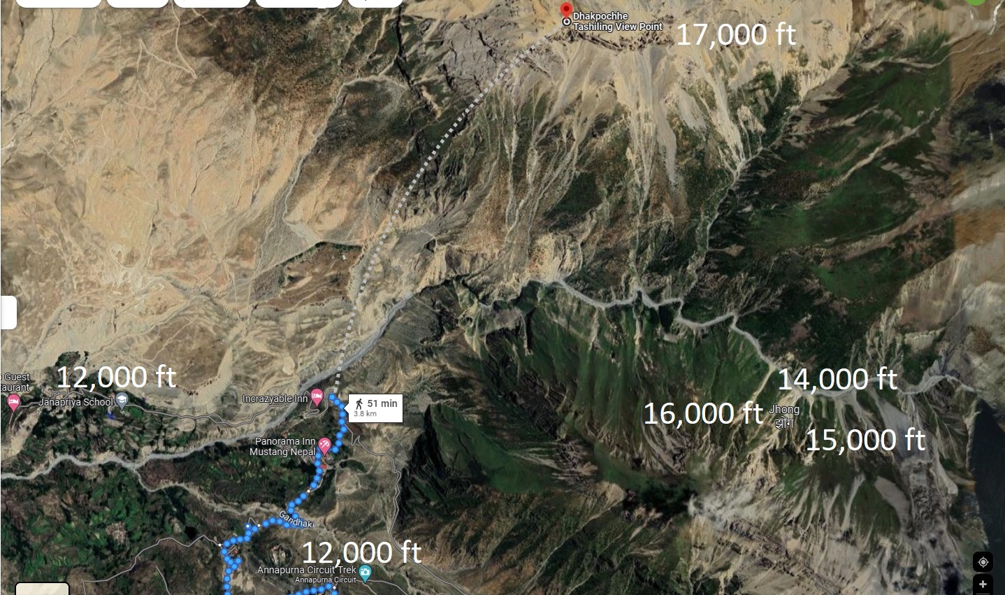
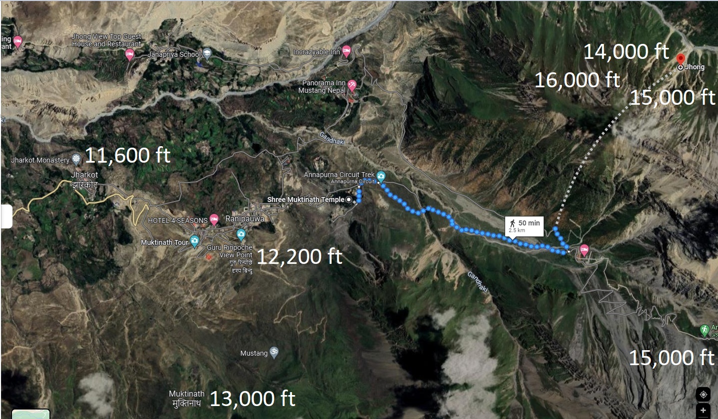
Below is trekking maps in Very High-Altitude (12,000 ft - 18,000 ft) topography between Muktinath Temple and
Thorong La Pass round trip which might span two days for our group. Altitude classified as Extreme Altitude that starts beyond 18,000 ft.